Welcome to Seagrass Spatial Lab

A single window entry point to the West Africa Seagrass database


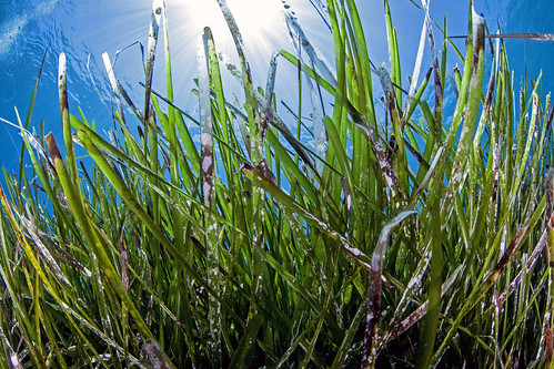
Seagrasses (or seagrass meadows if you prefer) play a significant ecological, economic and social role in West Africa. They provide food and shelter for fish, turtles, molluscs and crustaceans, improve water quality, store carbon, produce oxygen, protect the coastline, and help regulate the climate.

Read more »

Highlights of Available Datasets

Layers

Click to search for geospatial data published by other users, organizations and public sources. Download data in standard formats.


Layers 107

Maps

Data is available for browsing, aggregating and styling to generate maps which can be saved, downloaded, shared and many more.

Maps 8

Documents

As for the layers and maps portal allows to publish tabular and text data, manage theirs metadata and associated documents.


Documents 66

Users

Lab allows registered users to easily upload geospatial data and various documents in several formats.


Users 63